By Marissa Di Vita
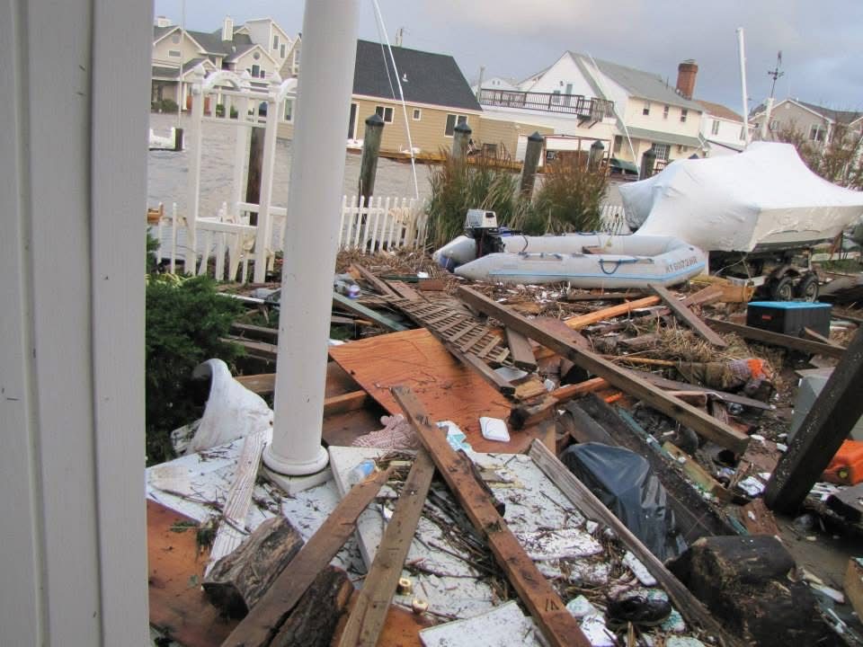
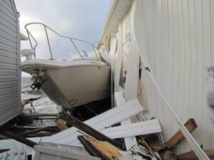
The front driveway of Ashley Wallace’s house on Bayview Avenue West in Lindenhurst, in the aftermath of Superstorm Sandy in October 2021. The Wallaces were left with no place to walk because of the debris, including large planks of wood and miscellaneous objects that covered every inch of the ground. A rescue boat is pictured among the debris next to a boat covered with a white tarp.
Photo by Ashley Wallace
Part two in a series.
On Oct. 29, 2012, the forecast predictions came true.
Residents had boarded up their windows, lined their homes with sandbags and set up generators. From Oct. 29 to 30, wind speeds of about 80 miles per hour battered homes across Long Island and New York City. The storm surge reached about five feet above normal tide levels in Suffolk County, and 43 residents lost their lives in New York City, with 53 total deaths reported statewide, according to New York City recovery reports and the National Hurricane Center.
Although most officials agree that recovery from Sandy took five to seven years, Town of Babylon Supervisor Rich Schaffer said the effects of the storm’s strength are still felt today, including beach erosion and homes that were never raised. Flooding in the area has remained a common occurrence, with beach erosion, rising sea levels and stronger storms acting as major contributors.
Residents say they have yet to find reason to trust the town’s solutions—pump installations to reduce flooding have proved inadequate, leaving residents feeling despondent after the 17th attempt at a pump installation. Residents in the lowest lying areas still move their cars off their streets ahead of heavy rain, and ongoing infrastructure issues have left many frustrated.
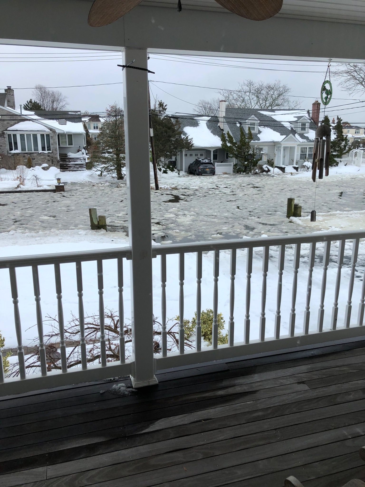
Flooding covered Eaton Lane outside Gayle Comerford’s home in West Islip in 2022, years after Hurricane Sandy in October 2012. Residents say flooding in the area has worsened since the storm, forcing neighbors to move their cars ahead of heavy rain.
Photo by Gayle Comerford
In Lindenhurst, coastal homes also sustained significant damage. After Ashley Wallace’s property was repaired and restored to its original beauty, the house was purchased by New York Rising, a program run by New York State at the time to buy houses within flood zones and demolish them. The program would either give people money to raise their homes or buy them at a market rate to demolish them.
Wallace said Lindenhurst is now full of empty lots sitting between occupied homes, leaving the neighborhood looking “awful” amid the neglected, overgrown land. “They’re overgrown and not well cared for. Now they’ve sold some of those empty lots off … but it’s still stipulated that they’re not allowed to build on them,” she said.
The storm’s effects were also felt by local businesses along the South Shore. Kelly Peckholdt, the owner of Positions Dance Studio in Babylon Village, said that although Sandy caused temporary closures and financial strain for some dance families, she did not see the same long-term business impact as the COVID-19 pandemic.
Because of the high demand for a program to help homeowners raise their homes, Schaffer said the Army Corps of Engineers recently began a pilot project to raise more homes within flood zones. The project involves grants provided for 50 homes to be raised in Fred Shores, a small neighborhood off South Little East Neck Road in Babylon Village that was heavily affected by the floodwaters of Sandy.
County officials say Sandy also permanently changed how emergency management agencies prepare for severe storms. Edward Schneyer, now the resource management officer, was, at the time of Sandy, the director of emergency management at the Suffolk County Office of Emergency Management, which is responsible for monitoring storms and maintaining the emergency operations center for all of Suffolk County.
Schneyer said more than 10,000 homes were flooded with one to six feet of water, with homes on Fire Island and the Barrier Islands most impacted. The Suffolk County OEM has since refined flood-risk protections and ensured plans are in place for future disasters to reduce risk and ensure residents know when their homes might be impacted.

A Suffolk County Office of Emergency Management map highlights hurricane storm surge zones across Long Island’s South Shore, including communities heavily impacted by Hurricane Sandy in 2012.
Graphic courtesy of the Suffolk County Office of Emergency Management
With 1,100 miles of shoreline across the county, Suffolk’s South Shore faced the brunt of the storm, although all 10 towns and 32 villages of Suffolk County are included in the OEM’s plans for future protection. Schneyer said it’s important that residents living in flood zones are “really aware of what’s going on and are properly insured because the damages are almost inevitable, depending on where you are and the size of the storm.”

Flooding covered Eaton Lane outside Gayle Comerford’s home in West Islip in 2025, more than a decade after Hurricane Sandy devastated Long Island. A car across the street sat in several inches of water.
Photo courtesy Gayle Comerford
Schaffer said today that the Town of Babylon is working with the Army Corps of Engineers to change the sand replenishment program to distribute sand every two to three years rather than the current policy’s five-year interval. To restore the sand, the Army Corps of Engineers provides a special pump that delivers sand to the beaches to protect them.
Schaffer said since Sandy, the Town of Babylon has seen many facilities become equipped with generators. Fire departments have added boats to provide immediate rescue during severe flooding, and their emergency response manuals have been revised to include procedures for addressing water infiltration into electrical systems. Critical procedures that officials learned from experiencing Sandy were incorporated into the manual.

Four men who were working on lifting Gayle Comerford’s house, sitting on it, following Hurricane Sandy in October 2012. Comerford and her family spent months out of their home until they could move back in.
Photo by Gayle Comerford
According to Schaffer, the area of the Great South Bay that lies adjacent to a portion of the South Shore coast saw dangerously high levels of nitrogen in the water post-Sandy. Nitrogen in saltwater ecosystems lowers oxygen levels in the water, killing sea life such as oysters and plant life such as seagrass, an important plant found along Long Island’s coast that provides a natural buffer against flooding.
Because of the drastic effects of the nitrogen in the water that towns like Babylon Village saw, a plan was approved to convert all plumbing systems with cesspools to sewer systems. Sewer installations and the removal of cesspools will drastically reduce nitrogen levels in the water.
The Suffolk County Water Quality Improvement Fund will receive $50 million in total sales tax revenue per year to provide sewers in additional areas of Suffolk County. Schaffer said it was designed to cut across generations and cover the entire county. The plan was approved by Suffolk County voters in 2024, and will remain in effect from 2025 through 2075.
Officials say Sandy recovery is complete, but residents on the coast still deal with flooding, the cost of raising their homes, empty lots and the memories of what was lost.